Travel time / Fixed routes
Travel time / Fixed routes define routes between Pickup and Dropoff, for which no calculation of the distance or duration of the trip should be carried out via Google Maps to calculate the rate.
For these routes, the duration of the trip and distance are stored manually in LimouRATE. This data is then used as the basis for calculating the rate according to the corresponding rate table (e.g. „My share“).
Application scenarios:
Trips whose duration is usually longer than the result of the calculation on Google Maps.
For example trips in very busy city centres.
Trips between two areas, which are to be used in several rate tables.
Travel time / Fixed routes versus Basic Rates
Travel time / Fixed routes
Mileage and time are defined manually when the entry is created.
The calculation result depends on the entries made under „PtP“ or „hourly“ in the corresponding rate table
Changes in the prices for hours and miles / kilometers automatically affect the prices of fixed routes.
In the case of a rate enquiry, a check is first made to see whether a rate based on the „Fixed routes“ can be calculated for this enquiry.
If this is the case, the distance and duration will not be calculated via Google Maps, the „Basic Rates“ will not be taken into account.
Basic Rates
Mileage and time are queried for each rate calculation at Google Maps.
The calculation result is the fixed rate for this article, which is stored under „Basic Rates“ in the corresponding rate table.
Rates for „Basic Rates“ have to be changed at article level in the individual rate table.
If the rate cannot be determined via „Fixed routes“, LimouRATE checks whether the request can be covered by a „Basic Rate“.
If this is not the case, the rules stored under „PtP“ or „hourly“ apply.
Basic Rates increase flexibility at the level of the individual rate table.
Create Travel time / Fixed route
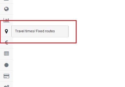
Click at the mentioned icon at the menu bar.

Click at „+ Add Route“.
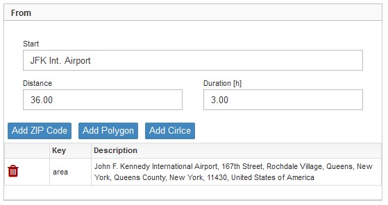
From
Start
Name / description of the pickup location
Distance
Distance in the unit (miles / kilometer) assigned to the price list.
This information replaces the calculation of the route via Google Maps.
Duration (h)
Duration of the trip to be taken into account for the rate calculation.
The following table defines the area(s) in which the pickup must be located.
Please follow this link to the description of how to create an area.
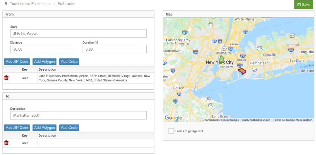
To
Destination
Name / description of the dropoff location
The following table defines the area(s) in which the pickup must be located.
Please follow this link to the description of how to create an area.
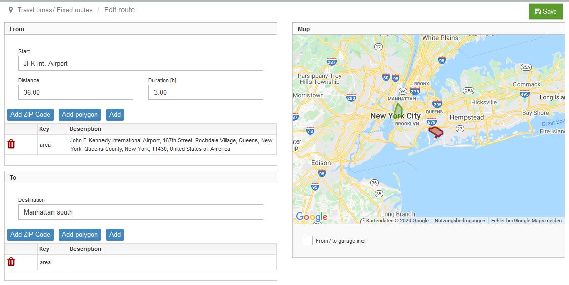
A Travel time / Fixed route is created.
Please do not forget to save the result of your work using the green „Save“ button in the top right corner.

Find a list with all stored fixed routes by using the mentioned icon at the menu bar.
For editing fixed routes please click the pencil button at the left.![]()
How to create an area
There are three ways to define an area for the pickup / dropoff:
- Add ZIP Code
- Add polygon
- Add (area)
To select the best fitting way please click the corresponding button.
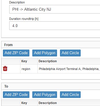
1. Add ZIP Code
Areas can by be defined by storing all ZIP-Codes of the related area.
Please click the button „Add ZIP Code„
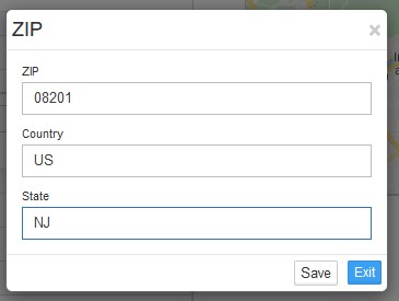
ZIP
ZIP code as officially defined
Country
Please use the related country code to make the specification clear.
Please find a listing of the related country codes following this link.
Further below is a list with the codes of the G20 countries and some other European countries in alphabetical order.
State
Mandatory for the USA to define the ZIP code. Please find the needed abbreviations following this link to US Postal Services.
Please confirm your entry by clicking the „Save“ button on the bottom right.
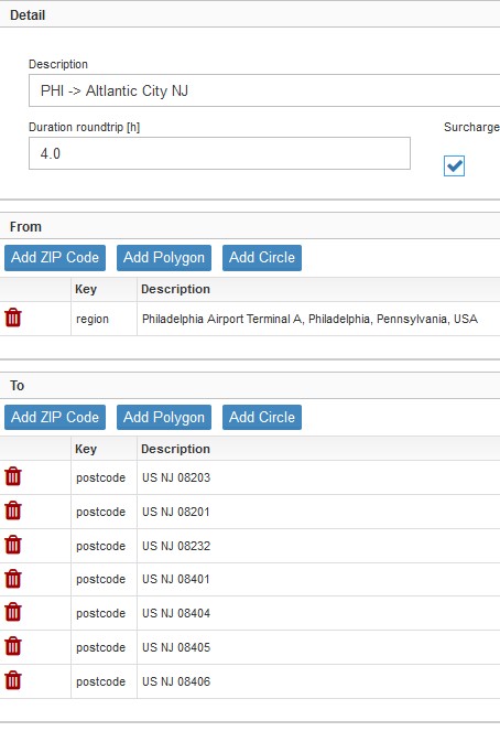
In the screenshot on the left side the dropoff area „Atlantic City (NJ)“ is defined by a list of the corresponding postal codes.
Please note:
Regions that are defined by postal codes are not visualized on the map on the right side!
Country Codes
AR
AU
BE
BR
CA
CN
DK
Argentina
Australia
Belgium
Brazil
Canada
China
Denmark
FI
FR
DE
GB
IN
ID
IE
Finland
France
Germany
Great-Britain
India
Indonesia
Ireland
IT
JP
MX
NL
NO
RU
SA
Italy
Japan
Mexico
Netherlands
Norway
Russian Federation
Saudi-Arabia
ZA
KR
ES
CH
SE
TR
US
South Africa
South Corea
Spain
Switzerland
Sweden
Turkey
United States of America
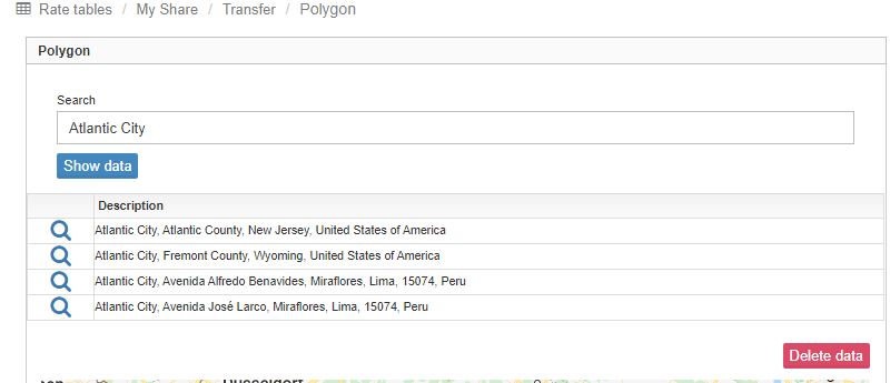
2. Add polygon
This a very powerful and time saving function.
Start this function by clicking the „Add polygon“ button in the detail view
1. Enter the name of a city or an area into the search field (here i.e. „Atlantic City“). Start the search by clicking the „Show data“ button.
2. Select the appropriate list entry by clicking on the magnifying glass symbol
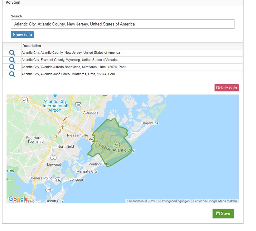
3. See the result at the map (scroll in and out by using the mousewheel)
4. Confirm by clicking the „Save“ button on the bottom right.
Note:
The polygon function will work for most cities, in many cases also for individual districts. In some cases, the necessary database for this function may not be available. In these cases please use the „Postcodes“ function or define the region manually using the „Add“ button.
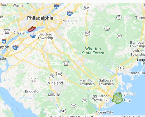
If „Add polygon“ was used to create the areas for pickup and dropoff, both areas are visualized on the map on the right side.
In this example pickup is at Philadelphia Int. Airport PHI, dropoff is at Atlantic City, NJ.
3. Add Circle
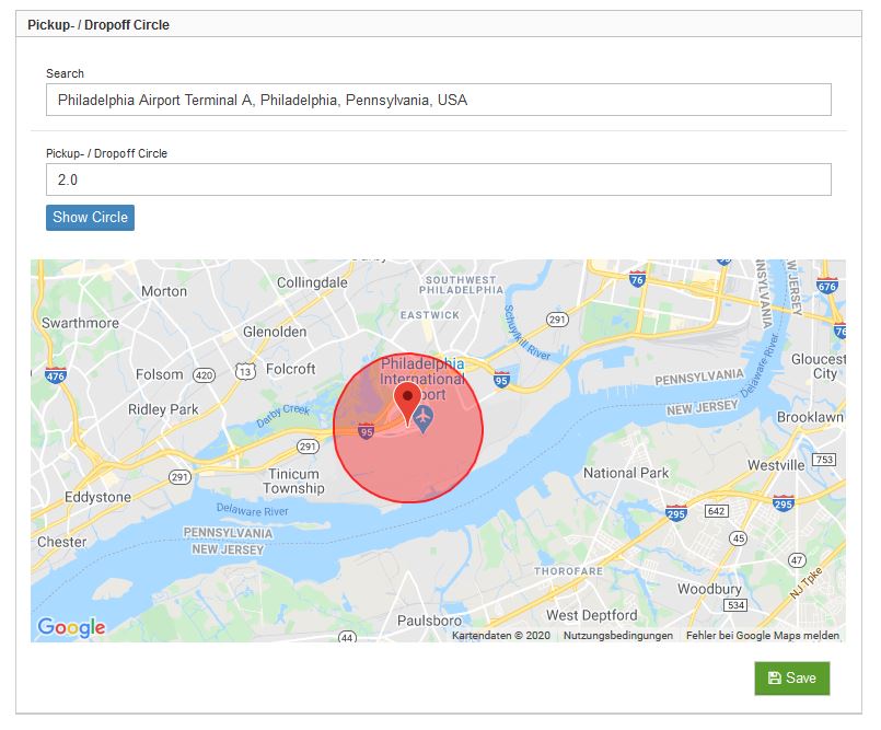
This function creates an area in the form of a circle with a defined radius around a desired point.
To start this function please click the „Add Circle“ Button on the detail view.
Search
Enter the desired address for the circle and complete by using the proposals from Google (needed to assign GPS data).
Pickup- / Dropoff Circle
Enter the desired radius of the circle in miles.
„Show Circle“ button
Click this button to show the circle at the map below.
Confirm by clicking the „Save“ button on the bottom right.

In this example the result is an airport arrival at PHI, defined by a circle with a radius of two miles, with dropoff at Atlantic City (NJ), defined by polygon function.
The estimated duration for the roundtrip is four hours.
Confirm by clicking the „Save“ button on the bottom right.
